Showing posts with label Dixie Summit. Show all posts

Sunday, March 26, 2017

Dixie Butte - Spring Ski 3/26/17

click on image for larger version
you can save the larger version as a .png file to your computer
open and be able to zoom in for more detail.


Location: Hwy 26 east to dixie summit sno park

Road & Trail Conditions: 26 clear, snopark mushy. FR 2610 all the way

Snow Conditions: declining base with 1-4" new sno

Skis on & temperature: 9:30am  33°

Skis off & temperature:  2:30 pm  36°

Distance: 10 miles, 2000' elevation climb

Rating (1-10; 10 awesome): 10 on the spring ski scale

Comments: some new sno at elevation, still pretty warm - dubious. snopark was very patchy & ice.  beginning of 2610 was questionable.  a few bare spots along 2610, one required skis off. almost turned around.

very glad didn't.  about 1/3 ascent sno got powder & deeper, some of the best of the season.  first 1/3 crusty on ascent, mushy on descent.  after that pretty darn good.

did first hot wax a few weeks ago which probably kept sticky sno off.  worth learning how to do it.  without, imagine would have used 1-2 applications of maxiglide on trail with marginal results.


1/2 mile from top a snosquall blew in, happened every trip up dixie this season. waited an hour huddled behind a skinny tree.  clouds socked in, visibility 20 yds.

planning to summit & practice turns down east slopes.  wind has swept slopes pretty bare. base has dropped considerably, lots of ground exposure.  low visibility & many exposed shrubs & rocks changed my mind.  with clear visibility could probably find a line.

stiff wind dropped windchill in 20's higher, disappeared lower; glad packed googles & winter layers.  even when snopark seems balmy, take winter gear!


last ski was 3/5 at anthony lakes practicing downhill turns.  paid off for today.  great downhill even along 2610, in some ways better than anthony.  powder!

last thurs. kayaked monument to spray, north fork, 60 sunny, blu skies, 26 miles, 3+ hrs. ski dixie today, back to winter.

~  i love this place ~

Monday, February 20, 2017

Dixie on Sunday Morning - 2/19/17

click on image for larger version
you can save the larger version as a .png file to your computer
open and be able to zoom in for more detail.

Location: Hwy 26 east to Dixie Summit sno park; FR 2610 to top

Road & Trail Conditions: 26 clear, snopark plowed packed sno & ice

Snow Conditions: 3' condensed, very firm base, 1/2 - 4" powder on top with elevation & as day progressed

Skis on & temperature: 9am 33° (JD  38° )

Skis off & temperature: 5:30pm 33° moderate sno (PC 36° rain; JD 39° rain)

Distance: 11.5 miles; 2 miles elevation

Rating (1-10; 10 awesome): 10 - bliss


Comments:  just when i think ski season is washed out...a day like today happens.

beginning of the 2610 at snopark looked a little thin & moist.  that improved quickly with elevation to some of the best powder on a solid base i've found this year.


this time of year i opt for elevation & dixie is the easiest access plus fastest climb.

dixie & i have a thing, if one can have a thing with a mtn.  i can see sno on strawberry &, yeah, i want to ski that.  when the sno is right on dixie, i have to go.  i now understand more about the siren's song.  started hearing the song on thurs.

went out to do this run 4 weeks ago, skis broke thru 8+" at sno park, would have been 16" at elevation.  no tracks, no base. headed back to starr ridge.

this run is a short 5 miles distance; 2 miles in elevation makes for some leg work up.  then there is coming down.

dixie falls in between the grooming area of grant co. snoballers & the burnt river club, so no grooming.  occasionally a county (?) snocat will make the journey up for com tower maintenance/repairs.  the occasional snomo will venture up, usually not to the top.  without these you need to wait for the base to consolidate & fresh powder on top.  like now.

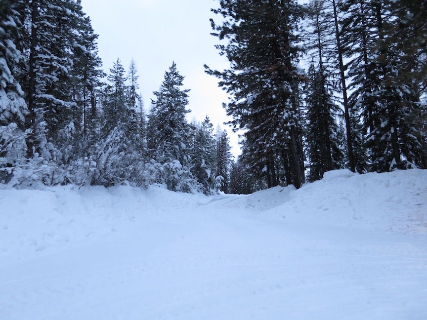
the first 3+ miles to the treeline is pretty easy altho continual uphill.  there are some great views south to the strawberry range and then a little higher, to the east & elkhorn range.  today was pretty cloudy

after leaving the treeline it's a steep west facing slope, exposed to constant winds creating deep sno drifts & today, an ice crust on top (see blue line on map above).  the road can be a concept rather than something obvious before you. i've got a gps with topo maps & roads.  i referred to it a lot to see if i was even close to being on the road even tho i've been up here several times.  along this west slope, you don't want to stray too far off course.

in general, west slope of dixie is steeper & typically has an icy, wind blown crust.  east slope has gentler slope & often awesome deep powder.

this trip is not for the faint of heart; need good leg conditioning, stamina (7600'); no skinny touring skis; take cold weather & wind gear (ski googles & balaclava) even when it is warm & sunny.  dixie has her own weather pattern.  storms that leave the valley can linger on dixie for quite a while. wind can be relentless. today, sustained ssw 20-30mph with gusts & blowing sideways sno.  i love it.

trip started nicely with partly sunny skies.  first squall came in from ssw:

first sno squall coming out of the south right at dixie


& i hunkered down behind a skinny tree for an hour about 1/2 mile from top.  couldn't see road or landmarks.

lone tree above treeline became new best friend


sky cleared & made a run at the top where another squall settled in.


cameras don't capture sno squalls too well

waited over 45 mins. & decided to start down as it was getting late.  first 1/2 mile was skiing by feel & gps. & then clouds lifted enough to see. sno squall dumped enough new to put a good powder covering over icy slope on return trip.

originally planned to come down from top & circle around knoll to SE (see orange dotted line on map above), getting into deeper powder on east side & practice backcountry downhill.  couldn't see any landmarks & opted to retrace route.  without gps, would have got seriously off course, on a steep slope.

lovely downhill through 2+" fresh powder from squalls since ascent.  short downhill runs at powerlines & ski hill at snopark.

while hunkered down at the top, wondering how i was going to get back,  a skier materialized from out of the clouds.  JP from baker drove over here to ski dixie. confessing he cheated, he snomo'd up to treeline & skied the rest of the way.  he had some awesome backcountry gear, locking boot heels, for just this kind of terrain.  i've been lusting after that gear.  i had been considering driving over to baker to ski anthony today.  hmmm......


Thursday, February 18, 2016

Dixie Butte - 2/18/16


click on image for larger version
you can save the larger version as a .png file to your computer
open and be able to zoom in for more detail.


Location: Hwy. 26 east of Prairie City to Dixie Summit Sno Park (permit required)

Road & Trail Conditions: Hwy 26 clear, plowed, wet, gravel at summit. FR 2610 1-2' compact base with .5-4" new sno depending on elevation

Snow Conditions: variable with elevation.  almost pristine at top, a little sticker at bottom, variable in between.

Skis on & temperature: 10:45am 36° mostly sunny (JD PC 47° )

Skis off & temperature: 2:45pm 36° moderate snow (JD PC 43° rain)

Distance: 8+ miles, 1.5 mile elevation - takes some legs & conditioning for the climb

Rating (1-10; 10 awesome): 10


Comments: almost spring skiing, still quite lovely.  another few degrees warmer or sunnier and the new snow would by sticky.  no travel on 2610 for several weeks.  without overnite snow, base would be slick ice.

spring rain in valley, snow on dixie


got to treeline; needed to head back.  great snow to summit. regular 20mph wind & 40mph gusts with moderate snow. a little intense.  past the treeline snow is deeper & drifts, still skiable.


snodrifts heading past treeline

almost perfect traction for elevation climb.  lovely downhill descent.  zippy in places, icy overhanging branches.  best downhill run of the season (not my strongest skill).


as long as the overnite temps get cold & with a few new .5" for several days in the forecast, could get back to great skiing conditions.

Friday, January 8, 2016

Dixie Butte FS 2610 rd - 1/7/16

click on image for larger version
you can save the larger version as a .png file to your computer
open and be able to zoom in for more detail.


Location: Hwy. 26 east of Prairie City to Dixie Summit Sno Park

this is what it looks like on a clear day....


this is what it looked like from the top today


Road & Trail Conditions: Hwy 26 clear; followed county sno cat tracks up the FS 2610 rd, several hrs. old. they were repairing a radio on the com towers. ideal groomed conditions. newest snomobile tracks had 4-8" of sno fill.

start of the fs 2610 rd; starr ridge snowsports park, tow rope to left


Snow Conditions: 2-5' with increasing elevation.  lt. to moderate sno flurries increasing with elevation to quite strong with 20mph wind on the butte -  visibility 10'. 1/2-1" accumulation at butte, very little accumulation lower.

Skis on & temperature:  9:30am 29° (JD33° );

Skis off & temperature: 3:45pm 33°  (JD 37° )

Distance: 5 miles, maybe; elevation 2700+' definitely

elevation profile
click on image for larger version
you can save the larger version as a .png file to your computer
open and be able to zoom in for more detail.


Rating (1-10; 10 awesome): 9.9 - clear day = 10

Comments: this is one of those ski season high points, literally. haven't done this much elevation before. sno & temp easy. great climb to the treeline then it gets very steep to the top.  from the top down to the treeline ended up being much more difficult, very fast & narrow.  thought the deep snow would help, didn't. also, thick clouds, wind & blowing snow at top decreased visibility to the point of obscuring tracks & hazards. dixie seems to have it's own weather patterns, often quite different from the rest of the john day river valley.

touring skis worked fine to the treeline; backcountry skis would have been more appropriate for the last segment

with the current conditions (deep at the top) unless you are very skilled at downhill, i'd either walk/snow shoe this section or turn around at the treeline. less deep snow might be more manageable.

4.5hrs up; 1.5 hrs. down

alternatives to this route are a network of trails that start from the east end of the sno park (096? - the rd. markers don't always match with the maps &, as you can see, are not always visible):


on the south side of 26 (maybe not a part of the sno park, no permit needed?) another road going south, popular with snomobiles, fs 132: